Belknap and Merrimack County Maps.
Though her church was established in Boston, Massachusetts, Mary Baker Eddy lived the majority of her life in New Hampshire. Thus it seems fitting that The Mary Baker Eddy Library has in its collection nineteenth century maps of two Granite State counties, Belknap and Merrimack.
Eddy’s connection with Merrimack County was the stronger, as she was born here in 1821, in the town of Bow. She lived there until 1836, when her family moved to Sanbornton Bridge. Merrimack County also includes the capital city of Concord, where Eddy lived from 1889 to 1908.
Belknap County was home to Sanbornton Bridge. Eddy lived here from 1836 until the time of her marriage to George Washington Glover in 1843. After his passing in 1844, she returned to live with her family until 1853, when she married Daniel Patterson.
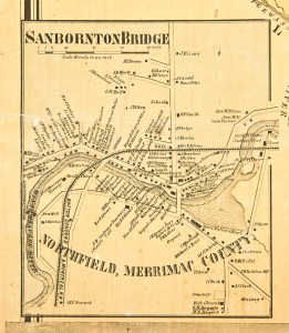
These two maps give helpful information about Eddy’s New Hampshire world, as well as about members of the Baker family. The Merrimack County map includes the property of her cousins Aaron and John Baker, father and son. The map of Sanbornton Bridge shows where the property of Mark Baker, her father, is located. It also locates properties for many Tiltons, the family into which Eddy’s sister, Abigail, had married. In 1869, nine years after this map was made, Sanbornton Bridge separated from Sanbornton and was renamed Tilton by its residents, in honor of the family.

Mark Baker’s house can be seen on the far left side of this inset map of Sanbornton Bridge. It is marked as “M. Baker.”
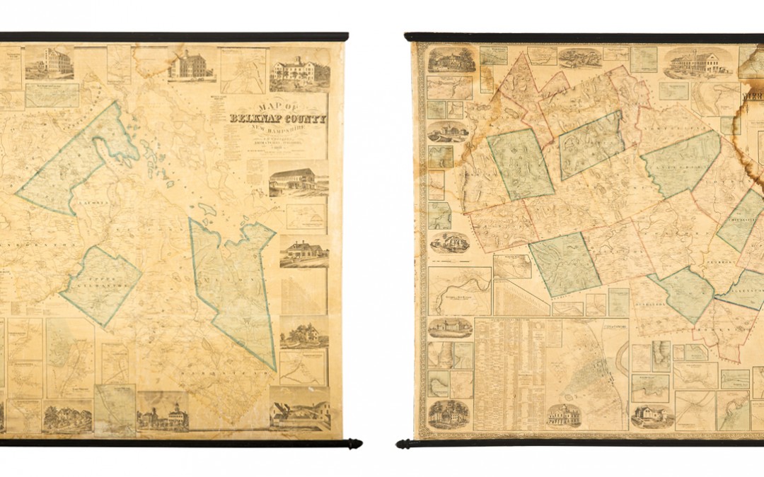
Advertisements in various newspapers from the period list these maps as selling for anywhere from three to five dollars each—quite a high price for those days. According to one newspaper ad, the Belknap County map “…should be in the hands of every family in Belknap County at all events. It will also be found very convenient for summer tourists about the Lake [Winnipesaukee, the largest lake in New Hampshire]….”1 But due to the price, the market for them was limited primarily to land and business owners, town and state governmental agencies, and those who could have afforded such items as ornamentations in their homes.Both county maps contain a great deal of other useful information. They show major roads, railroads, topographical features, and locations of farms and residences. They also provide insets of town plans, which detail houses, businesses, and streets. Additionally, both maps include vignettes of houses of prominent citizens, businesses, schools, and street scenes. These feature relatively intricate, well-executed drawings. Also included are business directories for select towns, and a chart of the distances in miles between towns.

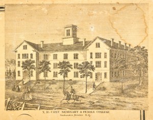
This vignette of the New Hampshire Conference Seminary and Female College in Sanbornton Bridge (later renamed Tilton) shows a great level of detail.
At roughly twenty-five square feet each, both maps are rather large but consistent in size with other county maps of the period. At some point the paper was coated with varnish and backed with linen. Both maps have wooden rods at the top and bottom, which would have made them easy to roll up and hang. Their similarity in size and design is due to the fact that both were published by the same company, H. & C. T. Smith & Peavey, with offices in Philadelphia, New York City, and Boston.
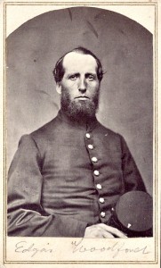
Little is known about Avon, Connecticut, native, Edgar Woodford (1824-62), the surveyor for the Belknap County map. According to the Connecticut Historical Society, “He was a self-taught civil engineer and surveyor” whose “name appears as surveyor on at least nine maps of Connecticut towns as well as maps of towns in Massachusetts, New Hampshire, and Maine….Woodford enlisted in the Seventh Connecticut Volunteer Infantry and died of congestive fever at Hilton Head, South Carolina in October 1862.”2 Henry Walling (1825-89), whose surveys formed the basis of the Merrimack County map, had a prolific and well-known career. He “unquestionably made the greatest contribution to town and county mapping in the fifth, sixth, and seventh decades of the nineteenth century.”3 Born in Providence, Rhode Island, Walling compiled and published plans of Cambridge, Massachusetts, Pawtucket, Rhode Island, and Providence, in the late 1840s and early 1850s. He also published several guidebooks, including an 1867 guide for New York City with a map inside. Walling was named Superintendent of the State Map in 1855 for Massachusetts. Due to the inaccuracies of a previous mapmaker, he was also directed to revise the state map of 1842. He was a prolific mapmaker; between 1848 and 1888 he prepared and published maps for no fewer than 20 states, 280 counties, and over 100 cities.
- “Belknap County Map,” Dover Gazette and Stafford Advertiser, February 26, 1860.
- “E. M. Woodford Biography,” Connecticut Historical Society, Accessed October 2, 2013, http://emuseum.chs.org:8080/emuseum/view/people/asitem/W/138?t:state:flow=4da7267f-ade4-4cca-bd79-8e7af4e3045e
- Walter Ristow, American Maps and Mapmakers (Detroit: Wayne State University Press, 1985), 387.


